Finding abandoned places in the UK used to mean word-of-mouth tips, years of local knowledge and a lot of wasted journeys to sites that had been demolished or redeveloped. Today, a combination of online communities, GPS map tools and systematic location research has transformed how urban explorers discover derelict buildings — but the fundamentals of finding good sites have not changed. Here is a complete guide to finding abandoned places near you across England, Scotland, Wales and Ireland.
1. Use a Dedicated Abandoned Places GPS Map
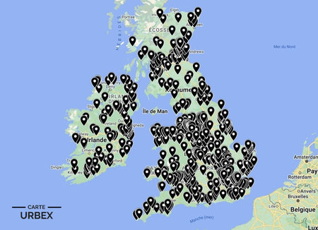
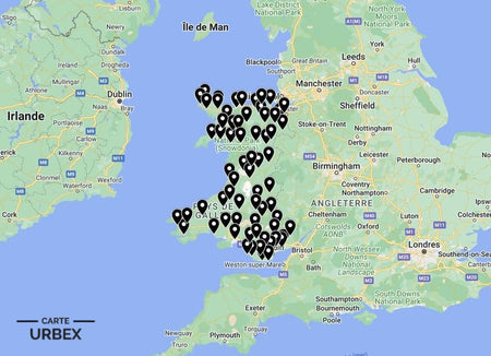
The fastest and most reliable way to find verified abandoned places near you is a dedicated GPS map curated by urban explorers. Our Abandoned Places Map UK contains 640+ verified GPS locations across England, Scotland, Wales and Ireland — including access ratings, condition reports and explorer reviews for every location. Unlike crowd-sourced maps that mix active and derelict sites, every location on our map has been verified as abandoned.
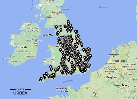
🏴 England Urbex Map — 400+ locations — 14,99€
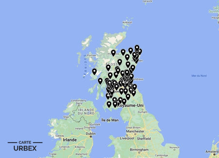
🏴 Scotland Urbex Map — 80+ locations — 9,99€
🏴 Wales Urbex Map — 60+ locations — 9,99€
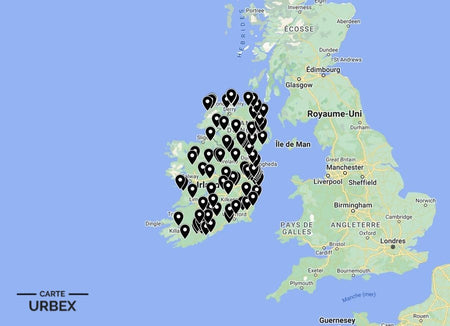
🇮🇪 Ireland Urbex Map — 100+ locations — 9,99€
2. UK Urbex Forums and Communities
The most active UK urbex communities operate as forums and social media groups where explorers share reports, access information and location tips. The key platforms are:
28DaysLater (28dayslater.co.uk) — the largest and longest-running UK urban exploration forum, with thousands of site reports organised by county and category. Reports include access information, condition notes and photography. The search function allows you to filter by location and site type.
Derelict Places (derelictplaces.co.uk) — a well-established UK urbex forum with a strong regional community structure. Particularly strong on hospital, asylum and industrial site reports.
Behind Closed Doors (bcd-urbex.com) — a high-quality UK urbex photography and report site with particular strength on Yorkshire, Lancashire and Scottish locations.
Instagram and TikTok — search #urbexuk, #abandoneduk or #abandonedplaces to find active UK explorers who regularly share location tags or county-level hints.
3. Google Maps Satellite View
Systematic Google Maps satellite searching is one of the most reliable methods for finding unknown derelict sites. Look for: overgrown rooflines in residential or industrial areas, collapsed roof sections visible from above, vegetation growing through buildings, isolated structures in otherwise cleared land and the characteristic texture difference between maintained and unmaintained roofing material. Zoom in on industrial corridors, hospital campus edges and former railway infrastructure.
4. Historic England and Listed Buildings Registers
Historic England publishes a Heritage at Risk register — a searchable database of listed buildings in poor or very bad condition that is one of the best systematic guides to at-risk derelict architecture in England. historicengland.org.uk/heritage-at-risk allows filtering by region, building type and condition. British Listed Buildings (britishlistedbuildings.co.uk) cross-references listing data with community photographs that often show current condition.
5. Old OS Maps and Planning Records
The National Library of Scotland's online map viewer (maps.nls.uk) overlays historical Ordnance Survey maps on modern satellite imagery — invaluable for identifying former industrial sites, hospital campuses and institutional buildings that no longer appear on modern maps. Planning portal searches for your local authority often reveal recently approved demolition orders, which in turn identify buildings that are currently still standing but scheduled — giving a window of exploration opportunity.
6. WWII Airfield and Military Heritage Databases
The UK has thousands of WWII airfield sites, many still with surviving control towers, blast pens and technical site buildings. The dedicated databases at airfieldresearchgroup.org.uk and subbrit.org.uk (for underground bunkers and ROC posts) provide comprehensive site information including current condition reports.
7. Local Newspapers and Planning Portals
Local newspaper archives are one of the most underused research tools for finding abandoned buildings. Articles about fire damage, planning applications for former institutional sites and heritage at-risk campaigns almost always reveal the location of currently derelict buildings. Your local council's planning portal lists all current and recent planning applications — searching for demolition orders, change of use applications and heritage consultations often reveals derelict sites not yet documented by the urbex community.
Safety First: The Urban Explorer's Code
Before visiting any abandoned place in the UK, always follow these principles. Never enter alone — always bring at least one other person. Tell someone where you are going and when you expect to return. Never remove anything from a site. Wear appropriate PPE — FFP2 mask for asbestos risk, sturdy footwear, gloves. Never enter buildings with visible structural collapse risk. Be aware that trespassing on private land without permission is a civil offence in England and Wales.
The urbex code: "Take nothing but photographs, leave nothing but footprints."
The Fastest Method: Our Verified GPS Maps
All the methods above take time and research. The fastest way to find verified abandoned places near you in the UK is our dedicated urbex GPS map — updated regularly, filtered by access rating and condition, covering 640+ locations across England, Scotland, Wales and Ireland.

Abandoned Places Map UK
- ✓ 640+ GPS locations across England, Scotland, Wales & Ireland
- ✓ Access ratings and condition reports for every location
- ✓ Instant access after purchase
- ✓ Free updates forever
19,99€
Find Abandoned Places Near Me →