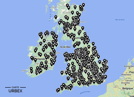
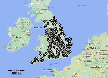
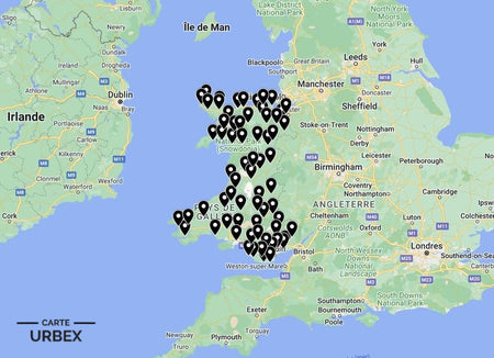
Northumberland is England's least populated county — a vast expanse of moorland, river valley, and coastal plain stretching from Hadrian's Wall to the Cheviot Hills. Its Roman military infrastructure, medieval border fortifications, and 20th-century coal mining heritage create an abandoned landscape of extraordinary historical depth and geographical isolation. Its abandoned sites range from a Georgian mansion deserted since 1937 and decaying in a Northumberland valley to a Cold War mock airfield in Kielder Forest and the ghost colliery infrastructure of the Great Northern Coalfield. Here are 5 of the best abandoned places in Northumberland, selected from our Abandoned Places Map UK — 640+ GPS locations across England, Scotland, Wales, and Ireland.
Why Northumberland Is a Hidden Gem for Urban Exploration
Northumberland's urbex landscape is defined by its remoteness — a county whose low population density and vast open landscape have preserved abandoned buildings in extraordinary atmospheric isolation. The Georgian country houses abandoned since the 1930s and 1940s stand in Northumberland valleys with no neighboring development for miles; the Cold War military infrastructure of Kielder Forest is accessible only by forestry tracks. The 28DaysLater Northumberland community is small but its documentation is exceptional.
1. Ewart Park Mansion – Wooler, Northumberland — 1780s Georgian Mansion Built by Count Horace St Paul, Grade II Listed, Abandoned Since 1937, Documented on 28DaysLater (Known Location)
Ewart Park Mansion near Wooler was built in the 1780s by Count Horace St Paul — one of the finest Georgian country houses in Northumberland, Grade II listed and standing in the Till Valley with the Cheviot Hills visible from its main rooms. The family abandoned the mansion in 1937 when Horace IV inherited the estate but had to pay off his father's debts and had nothing left to run it. The house has been decaying in Northumberland isolation since — one of the most thoroughly documented and most romantically atmospheric abandoned country houses in the northeast, explored extensively on 28DaysLater.
🔗 Learn more: Wikipedia – Ewart Park Northumberland
2. Ashington Colliery – Ashington, Northumberland — 1867-1988 Great Northern Coalfield Pit, World's Largest Coal Mining Village, Derelict Infrastructure (Known Location)
Ashington Colliery was the colliery at the heart of what was described as the world's largest coal mining village — a pit sunk in 1867 that at its peak employed thousands of Northumberland miners and created the social community of Ashington, famous for producing the Charlton brothers and the Pitmen Painters. The colliery closed in 1988; the derelict pit-head infrastructure and former colliery buildings still stand in the Ashington landscape as monuments to a community whose entire identity was built around coal extraction.
🔗 Also read: Top 5 Abandoned Places in England →

3. RAF Spadeadam Mock Airfield – Kielder Forest, Northumberland — Cold War Decoy Airfield, Abandoned Aircraft and Runway Infrastructure, Kielder Forest Setting, Documented on 28DaysLater (Known Location)
The RAF Spadeadam mock airfield in Kielder Forest is one of the most unusual pieces of Cold War abandoned infrastructure in England — a decoy airfield built to divert Soviet bombers from nearby RAF Spadeadam, complete with abandoned mock aircraft visible from the air and runway infrastructure in the Northumberland forest. Documented on 28DaysLater as one of the most unusual and most remote derelict military sites accessible from Northumberland — a Cold War deception installation whose purpose was to be bombed instead of the real airfield.
🔗 Learn more: 28DaysLater – Northumberland Urbex Reports
4. Northumberland Victorian Country House – 1860s-1880s Baronial Mansion, Grand Hall and Library Intact, Deer Park and Walled Garden, Northumberland Border Country (Exclusively on Our Map)
An 1860s-1880s baronial country house in the Northumberland Border Country — the original grand hall with its baronial fireplace, the library with original shelving, and the servants' wing still intact in atmospheric dereliction. Post-war death duties and the agricultural depression ended the Border gentry's ability to maintain these houses within a decade of 1945; Northumberland's remoteness has preserved them in remarkable atmospheric isolation. GPS coordinates available with our England Urbex Map.
5. Northumberland Bastle House – 16th-17th Century Fortified Farmhouse, Ground-Floor Byre and Upper Hall, Border Reiver Landscape (Only on Our Map)
A 16th-17th century bastle house in the Northumberland Border country — the characteristic two-story stone fortified farmhouse whose ground-floor byre protected cattle from Border Reivers and whose upper hall was reached by a removable external stair. The bastle house is a building typology unique to the Anglo-Scottish Border; hundreds survive in various states of atmospheric ruin across Northumberland and the Scottish Borders. Find it on our map — with access rating and condition report.
Safety Tips
- Remote access: many Northumberland urbex sites are genuinely remote — always carry a fully charged phone, map, and sufficient water; mobile signal is absent across most of the county
- Mine shafts: the Northumberland coalfield has numerous capped and uncapped shafts — never approach any ground depression near colliery sites
- Never explore alone — always bring at least one other person
The urbex code: "Take nothing but photographs, leave nothing but footprints."
❓ FAQ
What is the most famous abandoned place in Northumberland?
Ewart Park Mansion near Wooler — a 1780s Georgian country house built by Count Horace St Paul, Grade II listed and abandoned since 1937 when the family could no longer afford to run it. Documented extensively on 28DaysLater as one of the most atmospherically complete and most romantically isolated abandoned country houses in the northeast.
What is the RAF Spadeadam mock airfield?
A Cold War decoy airfield in Kielder Forest built near RAF Spadeadam to divert Soviet bombers — complete with mock aircraft visible from the air and runway infrastructure in the Northumberland forest. One of the most unusual pieces of Cold War abandoned infrastructure in England, documented on 28DaysLater as genuinely remote and genuinely strange.
What is a bastle house?
A 16th-17th century fortified farmhouse unique to the Anglo-Scottish Border — a two-story stone building whose ground floor protected cattle from Border Reivers and whose upper hall was accessible only by a removable external stair. Hundreds survive across Northumberland in various states of atmospheric ruin; the bastle house is perhaps the most distinctively local building type in England.
🎯 Summary
Northumberland's abandoned places range from a Georgian mansion decaying in a Cheviot valley since 1937 to a Cold War mock airfield with abandoned aircraft in Kielder Forest and 16th-century Border Reiver fortified farmhouses whose cattle byres are still intact in the moorland. Each of these 5 derelict buildings in Northumberland captures a different layer of England's most remote and most historically layered county.

Abandoned Places Map England
- ✓ 400+ GPS locations across England
- ✓ Exclusive locations not found anywhere else
- ✓ Instant access after purchase
- ✓ Free updates forever
14,99€
Explore All Locations →