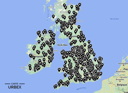
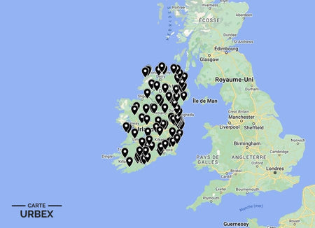
Galway is Ireland's western capital — the gateway city to Connemara and the Aran Islands, a medieval trading port whose extraordinary westward position on Galway Bay gives it a landscape and light quality unlike anywhere else in Ireland. Its abandoned places carry the full range of Irish western heritage: a 19th-century asylum that interned the psychiatric population of the entire province of Connacht behind its military-design X-shaped walls, a castle abandoned by the family that built the first transatlantic telegraph cable, and a Galway city castle whose family line ended in a fire that consumed everything. Here are 5 of the best abandoned places in Galway, selected from our Abandoned Places Map Ireland — 100+ GPS locations across Ireland.
Why Galway Is a Hidden Gem for Urban Exploration
Galway's urbex landscape is shaped by the extraordinary combination of the Connemara landscape's abandoned country houses and famine-era ruins, and the institutional heritage of a provincial capital whose Victorian civic ambition created hospitals, asylums, and infrastructure whose scale has never been matched by subsequent economic activity. Ballinasloe's St Brigid's Hospital alone is one of the most extraordinary pieces of derelict institutional architecture in the British Isles.
1. St Brigid's Hospital – Ballinasloe, Co Galway — 1830 Connacht District Lunatic Asylum, X-Shaped Military-Design Plan, Prison-Like Walls, 2,000+ Patients, Documented by Abandoned World Photography (Known Location)
St Brigid's Hospital at Ballinasloe was established as the Connacht District Lunatic Asylum in 1830 — one of 22 Irish asylums built between 1810 and 1870, whose military-inspired X-shaped design and prison-like walls confined hundreds and later thousands of patients under the Dangerous Lunatics Act. At its Victorian peak, the asylum interned over 2,000 patients, most of whom spent the rest of their lives within its walls; thousands died of tuberculosis in the adjoining fever hospital. Documented by Abandoned World Photography as one of the most atmospheric, most historically significant, and most architecturally extraordinary derelict psychiatric institutions in Ireland — the sheer scale, the X-plan prison geometry, and the adjoining graveyard make Ballinasloe unlike any other abandoned building in the country.
🔗 Learn more: abandonedworldphotography.com – Ireland Urbex
2. Clifden Castle – Clifden, Connemara — 1815 Country House of John D'Arcy, Abandoned, First Transatlantic Telegraph Cable Connection Nearby, Connemara Atlantic Setting (Known Location)
Clifden Castle in Connemara was built in 1815 by John D'Arcy — the founder of Clifden town and a major figure in the development of Connemara. The castle was later associated with the Marconi wireless station and the Alcock and Brown transatlantic landing site nearby. Now standing in atmospheric ruin in the Connemara Atlantic landscape, the castle ruins, the bog surrounding the site, and the extraordinary Atlantic horizon visible from the castle walls make Clifden one of the most dramatically sited abandoned castle ruins in Ireland. Documented on discover.re as one of Galway's most atmospheric derelict heritage sites.
🔗 Also read: Top 5 Abandoned Places in Ireland →

3. Menlo Castle – Menlo, Galway City — 16th-Century Castle, Destroyed by Fire 1910, Roofless Shell Above the Corrib, Documented by Atlas Obscura (Known Location)
Menlo Castle on the River Corrib above Galway city is one of Ireland's most romantically atmospheric castle ruins — a 16th-century Blake family castle destroyed by fire in 1910 when the last family member, an elderly woman, died in the blaze. The roofless shell rises above the Corrib with the water visible through the window embrasures; the ivy-covered limestone walls and the riverside setting create one of the most powerfully atmospheric pieces of abandoned medieval heritage in the west of Ireland. Documented by Atlas Obscura as one of Galway's most extraordinary and most accessible abandoned sites.
🔗 Learn more: Atlas Obscura – Menlo Castle Galway
4. Connemara Famine Village – 1840s Cleared Settlement, Stone Cottage Ruins, Bog Landscape, North Connemara Setting (Hidden Gem — Our Map Only)
A famine-era village in the North Connemara bog landscape — roofless stone cottage ruins, the lazy-bed cultivation ridges still visible in the rough bog pasture, and the stone field walls of a community that the Great Famine and subsequent emigration emptied in the 1840s-1860s. Connemara was one of Ireland's most severely affected regions; the abandoned village landscape of the Connemara bog is one of the most emotionally resonant and most atmospherically complete pieces of famine-era heritage in the west of Ireland. GPS coordinates available with our Ireland Urbex Map.
5. Galway Bay Coastguard Station – 1820s-1840s Royal Coastguard Station, Boathouse and Watch Tower, Galway Bay Setting (Off the Radar — Our Map Only)
An 1820s-1840s Royal Coastguard station on the Galway Bay coast — the original boathouse where the rescue boat was launched through the bay entrance, the watch tower, and the coastguard cottages in atmospheric dereliction above the Atlantic. The Irish coastguard station heritage is among the least documented and most architecturally distinctive pieces of early 19th-century institutional buildings in the country; the Galway Bay examples are the most dramatically sited of all. Included in our Ireland collection — 100+ locations.
❓ FAQ
What is the most famous abandoned place in Galway?
St Brigid's Hospital at Ballinasloe — the 1830 Connacht District Lunatic Asylum whose military X-shaped plan, prison-like walls, and peak population of over 2,000 patients make it one of the most extraordinary and most historically disturbing pieces of derelict institutional architecture in Ireland. Documented by Abandoned World Photography as a landmark Irish urbex site.
What happened at Menlo Castle?
A 16th-century Blake family castle on the River Corrib above Galway city, destroyed by fire in 1910 when the last family member — an elderly woman — died in the blaze. The roofless limestone shell with the Corrib visible through the window embrasures is one of the most romantically atmospheric castle ruins in the west of Ireland, documented by Atlas Obscura.
Why was Connemara so badly affected by the Great Famine?
Connemara's population was almost entirely dependent on the potato crop — the thin bog soils could grow little else at subsistence level. When the blight struck in 1845, entire communities lost their food supply simultaneously. The landlord-driven clearances that accompanied the famine years emptied hundreds of townlands; the abandoned stone cottage villages in the Connemara bog are the most complete and most emotionally resonant famine landscape in Ireland.
Safety Tips
- Bog terrain: Connemara bog is unstable and conceals deep water — always stay on visible tracks or paths and never walk onto apparently solid bog surface away from established routes
- Coastal exposure: Galway Bay coastguard station sites are exposed to Atlantic weather — always check forecasts and never approach cliff edges or unsecured coastal structures in strong wind
- Never explore alone — always bring at least one other person
The urbex code: "Respect the decay. It tells the story."
🎯 Summary
Galway's abandoned places range from a Connacht asylum that interned 2,000 patients behind X-shaped prison walls to a Connemara castle associated with the first transatlantic connections and a Corrib riverside ruin where a family line ended in fire in 1910. Each of these 5 derelict buildings in Galway captures a different layer of Ireland's most atmospheric western province.

Abandoned Places Map Ireland
- ✓ 100+ GPS locations across Ireland
- ✓ Exclusive locations not found anywhere else
- ✓ Instant access after purchase
- ✓ Free updates forever
9,99€
Explore All Locations →